Fexeiro:Belgium - Location Map (2013) - BEL - UNOCHA.svg

Fexeiro oureginal (fexeiro SVG, de 254 × 254 píxeles, tamanho: 905 KB)
_-_BEL_-_UNOCHA.svg)
Çcriçon de l fexeiro
| Çcriçon |
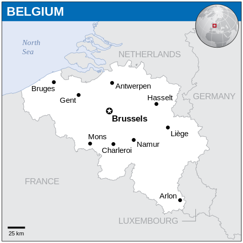
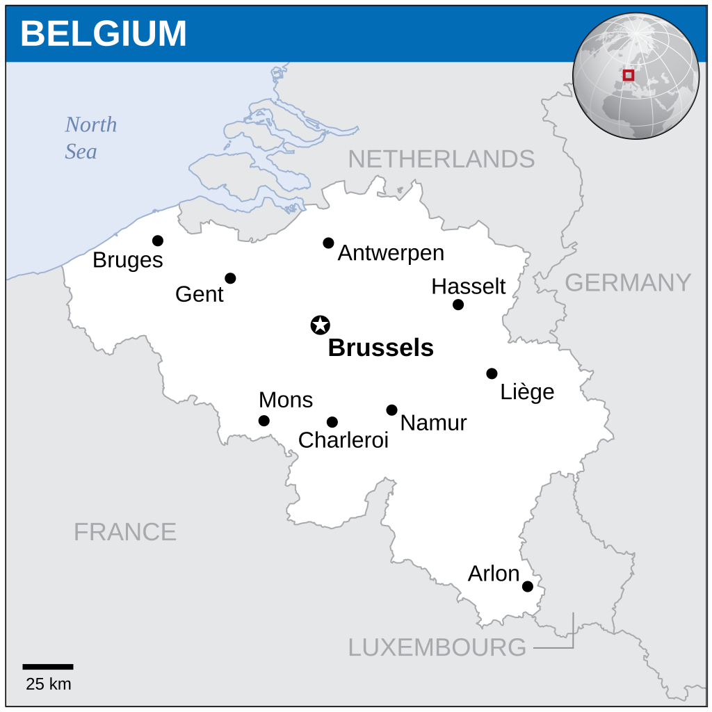
English: Locator map of Belgium. |
| Data | |
| Fuonte |
English: Belgium Locator Map (ReliefWeb), ESRI, UNCS |
| Outor | |
| SVG desenvolvimento |
Lhicença
- Sós lhibre pa:
- partilhar – copiar, çtribuir i trasmitir la obra
- recumbinar – criar obras deribadas
- De acuordo culas seguintes cundiçones:
- atribuiçon – Ten de atribuir la outoria de la obra, de la forma specificada pul sou outor ó lhicenciante (mas nun de forma a sugerir que estes l apoian ó subscrebem l sou uso de la obra).
 This map is part of a collection of 216 free country maps, created by the UN Office for the Coordination of Humanitarian Affairs (OCHA), to be used in print, web or broadcast products.
The ReliefWeb Location Maps released here are maps that highlight a country, its capital, major populated places and the surrounding regions. Attribution Requirements
Using the map without modifications: ensure that the sources and the disclaimer are below the map. Credit as follows: "Credit: OCHA". For use with alteration: remove the OCHA logo and disclaimer following any modification to the map, but keep the data sources as mentioned below the map. Credit the modified map as follows: "Based on OCHA map". You are responsible for the content of your map. We are keen to receive your feedback and hear how you used OCHA's maps. We would be grateful if you would notify us by e-mail and share your work with us. UN Disclaimer
The designations employed and the presentation of material of this map do not imply the expression of any opinion whatsoever on the part of the Secretariat of the United Nations concerning the legal status of any country, territory, city or area or of its authorities or concerning the delimitation of its frontiers or boundaries. |
Stórico de l fexeiro
Clique an ua data/hora para ber l fexeiro tal cumo el staba naquel sfergante.
| Data i hora | Amostra | Tamanho | Outelizador | Comentairo | |
|---|---|---|---|---|---|
| atual | 17h21min de 4 de febreiro de 2024 | | 254 × 254 (905 KB) | Illchy | File uploaded using svgtranslate tool (https://svgtranslate.toolforge.org/). Added translation for id. |
| 19h33min de 7 de nobembre de 2014 |  | 254 × 254 (904 KB) | GermanJoe | watermark removed | |
| 22h26min de 13 de márcio de 2014 |  | 254 × 254 (948 KB) | UN OCHA maps bot | == {{int:filedesc}} == {{Information |description={{en|1=Locator Map of Belgium. {{OCHA map}}}} |date=2013 |source=[http://reliefweb.int/map/belgium/belgium-location-map-2013 Belgium Locator Map (ReliefWeb)] |author=[[w:United Nations Off... |
Lhigaçones de l fexeiro
Esta páigina lhiga este fexeiro:
Outelizaçon global dun fexeiro
Las seguintes wikis outelizan este fexeiro:
- Outelizaçon na az.wiktionary.org
- Outelizaçon na ban.wikipedia.org
- Outelizaçon na bh.wikipedia.org
- Outelizaçon na csb.wikipedia.org
- Outelizaçon na es.wikipedia.org
- Outelizaçon na eu.wikipedia.org
- Outelizaçon na fa.wikipedia.org
- Outelizaçon na id.wikipedia.org
- Outelizaçon na incubator.wikimedia.org
- Outelizaçon na ka.wikipedia.org
- Outelizaçon na min.wikipedia.org
- Outelizaçon na mk.wikipedia.org
- Outelizaçon na ml.wikipedia.org
- Outelizaçon na sco.wikipedia.org
- Outelizaçon na sh.wikipedia.org
- Outelizaçon na simple.wikipedia.org
- Outelizaçon na so.wikipedia.org
- Outelizaçon na te.wikipedia.org
- Outelizaçon na trv.wikipedia.org
- Outelizaçon na ur.wikipedia.org
- Outelizaçon na zh.wikipedia.org
_-_BEL_-_UNOCHA.svg)